Gold mine in Mali. 531 koz in 2025, Mali’s largest producer (B2Gold FY2025)
Origin: Mali
Region: Kayes & western Mali
Site data
- Commodity: Gold
- Tier: Tier 1 (03 Resources Map tier rule)
- Status: Producing: Producing; Menankoto exploitation permit granted 7 Aug 2026
- Operator / ownership: B2Gold (Canada) 80%, Mali 20%; Fekola Regional (Menankoto) B2Gold 65%, Mali 35%
- Production: 531 koz in 2025, Mali’s largest producer (B2Gold FY2025)
- Coordinates: 12.5331, -11.3575 (OSM (power station); consistent with ‘40 km S of Kéniéba’)
Security context
- Mali’s largest gold producer in 2025 (17.5 t). B2Gold says operations ran uninterrupted through the fuel blockade (Nov 2025).
- ~15 Feb 2024: a B2Gold staff bus ~75 km west of Bamako was attacked, 3 employees killed (attackers unknown). Kéniéba cercle is on the Chinese embassy’s Dec 2025 list of places where Chinese nationals were kidnapped or killed.
- The new Fekola Regional (Menankoto) permit follows the 2023 code: 35% to the state.
Sources
- B2Gold FY2025 6-K: https://www.sec.gov/Archives/edgar/data/1429937/000117184326000905/exh_991.htm
- Northern Miner, Menankoto permit, Aug 2026: https://www.northernminer.com/news/b2gold-wins-mali-permit-after-guidance-cut/1003893822/
- Map and tier rule: 03 Resources Map
Relationships
- Area contested by: JNIM
- Supply roads hit by: Bamako fuel blockade (2025-26)
Media
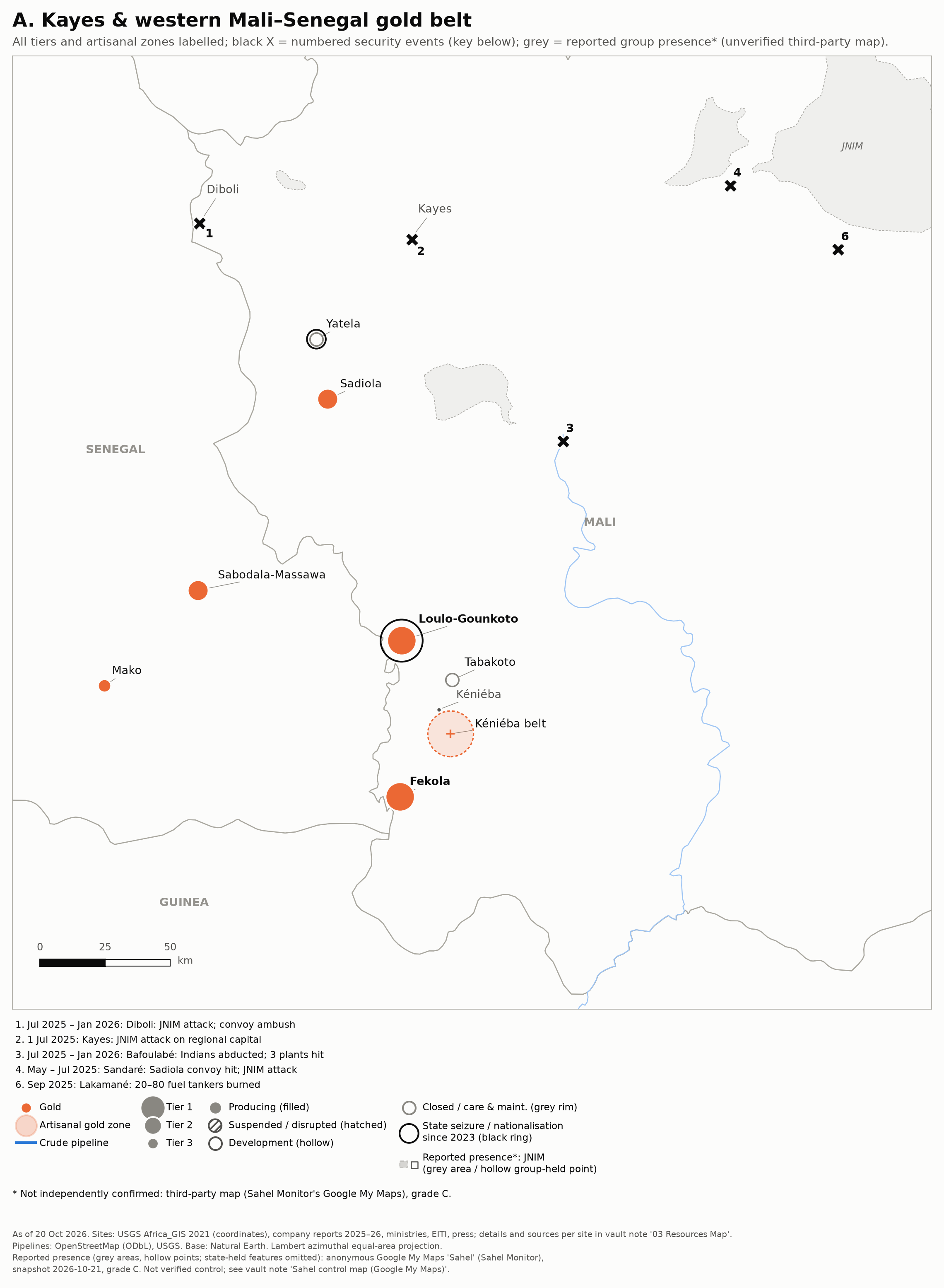 Zoom A: Kayes and the western Mali–Senegal gold belt.