Gold mine in Mali. ~194 koz in 2025 (Allied Q4 2025)
Origin: Mali
Region: Kayes & western Mali
Site data
- Commodity: Gold
- Tier: Tier 2 (03 Resources Map tier rule)
- Status: Producing: Producing; phase-1 expansion to 200–230 koz/yr
- Operator / ownership: Allied Gold (Canada) 80%, Mali 20%; Zijin (China) ~9.2% of Allied after the takeover was dropped (Jul–Aug 2026)
- Production: ~194 koz in 2025 (Allied Q4 2025)
- Coordinates: 13.8833, -11.7000 (WP; Sadiola Hill pit 13.863,-11.612 (USGS))
Security context
- 4 May 2025: a convoy carrying mining equipment from Bamako to Sadiola was attacked between Diéma and Sandaré. Sep–Oct 2025: the army held ~70 Allied-bound fuel tankers at Diboli and Kayes for escorts during the JNIM blockade.
- Zijin (China) agreed in Jan 2026 to buy Allied Gold for C$5.5bn; the deal lapsed ~29 Jul 2026 and was replaced by a ~9.2% placement. Next door, the state took the closed Yatela mine for its company SOREM in Jun 2025 (Tier 3 table in 03 Resources Map).
Sources
- Allied Gold 6-K 2026 (Zijin placement): https://www.sec.gov/Archives/edgar/data/1993344/000117184326004980/exh_991.htm
- Map and tier rule: 03 Resources Map
Relationships
- Convoy attacked by (May 2025, suspected): JNIM
- Supply roads hit by: Bamako fuel blockade (2025-26)
Referenced by
Media
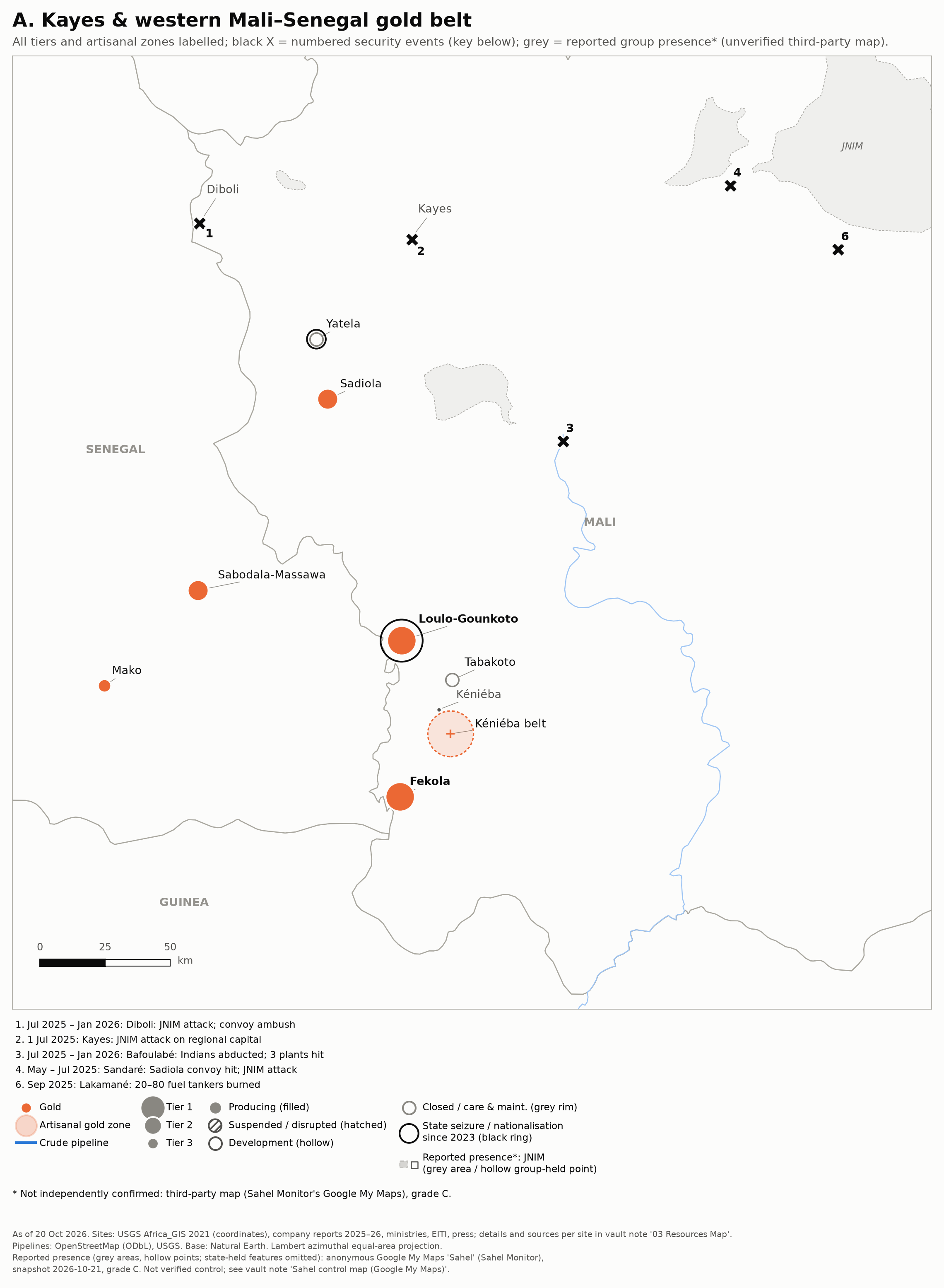 Zoom A: Kayes and the western Mali–Senegal gold belt.