Crude oil export pipeline in Niger / Benin. 1,950 km (1,275 in Niger, 675 in Benin); 90–110 kb/d design; first crude at Sèmè Apr 2024
Origin: Niger / Benin
Region: Diffa, Northern Benin
Site data
- Commodity: Crude oil
- Tier: Tier 1 (infrastructure; see 03 Resources Map)
- Status: Operating with repeated interruptions
- Operator / ownership: WAPCO (CNPC subsidiary), 15% Niger state
- Production: 1,950 km (1,275 in Niger, 675 in Benin); 90–110 kb/d design; first crude at Sèmè Apr 2024
Security context
- Built and run by CNPC’s WAPCO; first crude at Sèmè in Apr 2024. Benin blocked loadings in May 2024 in the border dispute with Niger, and Niger shut the line in June before exports resumed in Aug 2024. Exports have been ‘regularly interrupted’ since; each shutdown day costs ~400M advance to the junta is delayed by sabotage.
- Attacks: see Niger oil pipeline attacks (2024-26). No pipeline attack has been claimed by JNIM or the ISSP; the attackers are Nigerien rebels (FPL, then MPLJ). The Benin leg crosses Northern Benin, JNIM’s main coastal expansion zone, so far without a pipeline incident.
- Map geometry: the Benin leg is the detailed OSM trace; the Niger leg in OSM is a coarse 37-point line, so treat its position as approximate.
Sources
- Wikipedia, Niger–Benin Oil Pipeline: https://en.wikipedia.org/wiki/Niger%E2%80%93Benin_Oil_Pipeline
- ADF, rebels target Niger’s oil revenue, Feb 2026: https://adf-magazine.com/2026/02/rebels-target-niger-juntas-oil-revenue/
- The Diplomat, Apr 2026: https://thediplomat.com/2026/04/chinas-4-5-billion-headache-the-niger-benin-pipeline-and-the-limits-of-non-interference/
- S&P Global, FPL claim, 18 Jun 2024: https://www.spglobal.com/commodity-insights/en/news-research/latest-news/crude-oil/061824-armed-group-says-it-attacked-troubled-niger-benin-oil-pipeline
- African Security Analysis, MPLJ double attack: https://www.africansecurityanalysis.com/reports/mplj-double-attack-on-oil-infrastructure-in-niger
- OpenStreetMap way 1225590061 (route geometry): https://www.openstreetmap.org/way/1225590061
- Map and tier rule: 03 Resources Map
Relationships
- Sabotaged by (FPL/MPLJ rebels): Niger oil pipeline attacks (2024-26)
- Guarded by: FAN (Niger)
- Crosses: Benin armed forces
- Chinese interests (PSC context): Chinese private security companies
Referenced by
- Agadem oil block (Exports through)
- Niger oil pipeline attacks (2024-26) (Target)
Media
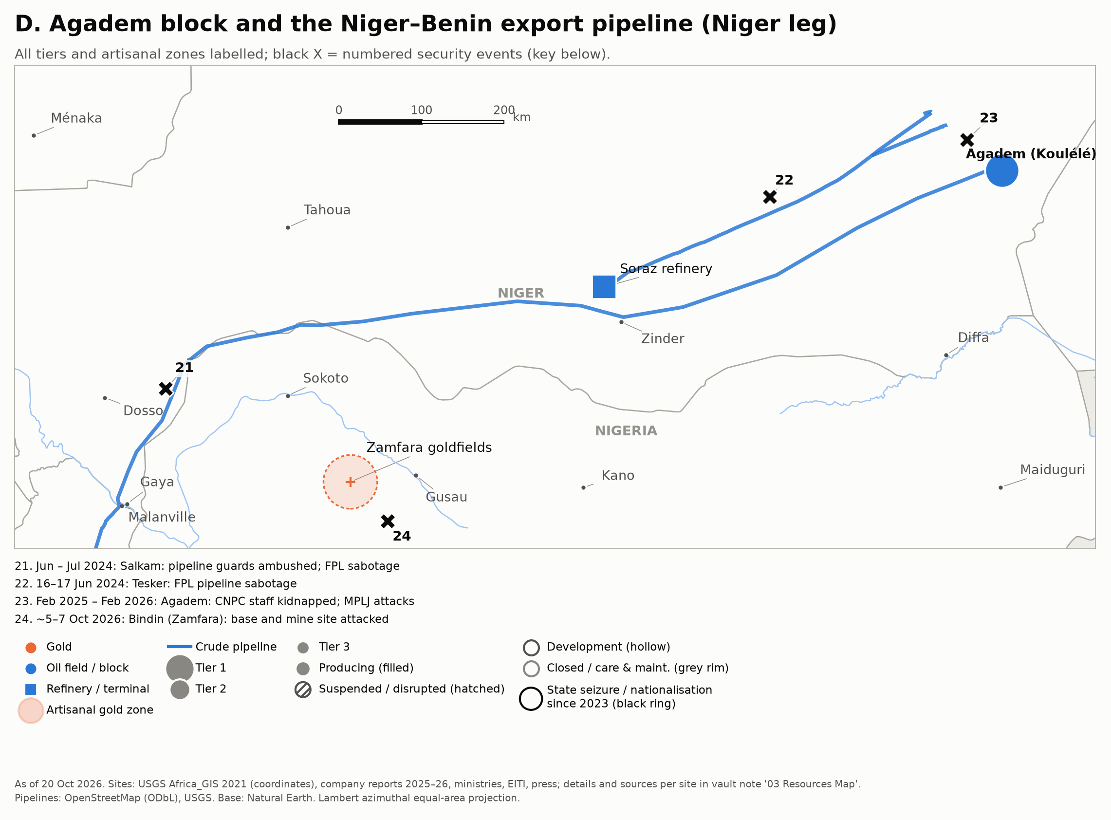 Zoom D: the Niger leg and attack sites.