Gold artisanal zone in Mali. Largest artisanal site in northern Mali; up to ~4,000 miners (UN, 2020)
Origin: Mali
Region: Gao & Ménaka
Site data
- Commodity: Gold
- Tier: Artisanal zone (no reliable production figure; separate marker)
- Status: FAMa-held again since ~17–18 Oct 2026
- State takeover flag: yes (seizure, nationalisation, permit withdrawal or state administration since 2023)
- Operator / ownership: SOREM (Malian state) permit, 97 km²; previously taxed by GATIA, CSP/FLA, JNIM and ISSP
- Production: Largest artisanal site in northern Mali; up to ~4,000 miners (UN, 2020)
- Coordinates: 16.2036, -0.4769 (fr.WP/OSM village on the RN16, ~47 km W of Gao; Sahel Monitor pins 16.048,-0.497; pits may lie ~20 km NW)
Security context
- The largest artisanal gold site in northern Mali (Gourma side of the Niger, ~47 km west of Gao on the RN16; up to ~4,000 miners). Taxed for years by successive armed groups and in recent years managed by the pro-Bamako GATIA.
- 10 Feb 2024: FAMa and Wagner seized it and Wagner handed it to FAMa the next day. 23 Oct 2025: FAMa ‘Operation Dougoukoloko’ moved in after an ultimatum to miners; 15 Nov 2025 the army took full control, halted extraction and gave the site to the state company SOREM. The FLA called it ‘plundering of Azawad’. The Sentry (Apr 2026) says Africa Corps was sent to oversee it and the army bombed parts of the site to drive miners out.
- ~27 Apr 2026: FAMa and Africa Corps withdrew in a negotiated pull-out during the April 2026 FLA-JNIM offensive, leaving the site to the FLA/JNIM coalition.
- ~17–18 Oct 2026: FAMa back at the mine; the mines minister visited on 17 Oct (bamada.net), while Malijet dates the recapture to 18 Oct, so the exact day is uncertain (C3, Sahel Monitor, t.me/sahelmonitor/497, 18 Oct 2026), (D3, Departamente, t.me/departamente/8278, 19 Oct 2026), (D3, Belye Dyadi v Afrike (wagner_group2022), t.me/wagner_group2022/19147, 19 Oct 2026). Footage relayed by SouthFront suggests Africa Corps presence. Sahel Monitor’s pin (16.048, −0.497) is ~17 km south of the village point used on the map.
Sources
- All Eyes on Wagner, ‘Gold thirst’, 12 Feb 2024: https://alleyesonwagner.org/2024/02/12/gold-thirst/
- L’Economiste du Mali, 17 Nov 2025: https://leconomistedumali.com/intahaka-une-mine-dor-strategique-reprise-par-letat-malien/
- bamada.net, minister’s visit, 19 Oct 2026: https://bamada.net/region-de-gao-le-ministre-des-mines-a-la-tete-dune-forte-delegation-en-visite-a-la-mine-dor-dintahaka
- SouthFront relaying Malijet, 19 Oct 2026: https://maps.southfront.press/malian-forces-retake-strategic-intahaka-gold-mine-videos
- Map and tier rule: 03 Resources Map
Relationships
- Seized (Feb 2024): Wagner Group
- Seized (Feb 2024) and retaken (Oct 2026): FAMa (Mali)
- Overseen by (2025–26, reported): Africa Corps
- Managed before 2024: GATIA
- Held after Apr 2026 withdrawal: FLA
- Held after Apr 2026 withdrawal: JNIM
- Taxed (historically): ISSP
- Lost in: April 2026 FLA-JNIM offensive
- Retaken after: Kidal retaken (Oct 2026)
Media
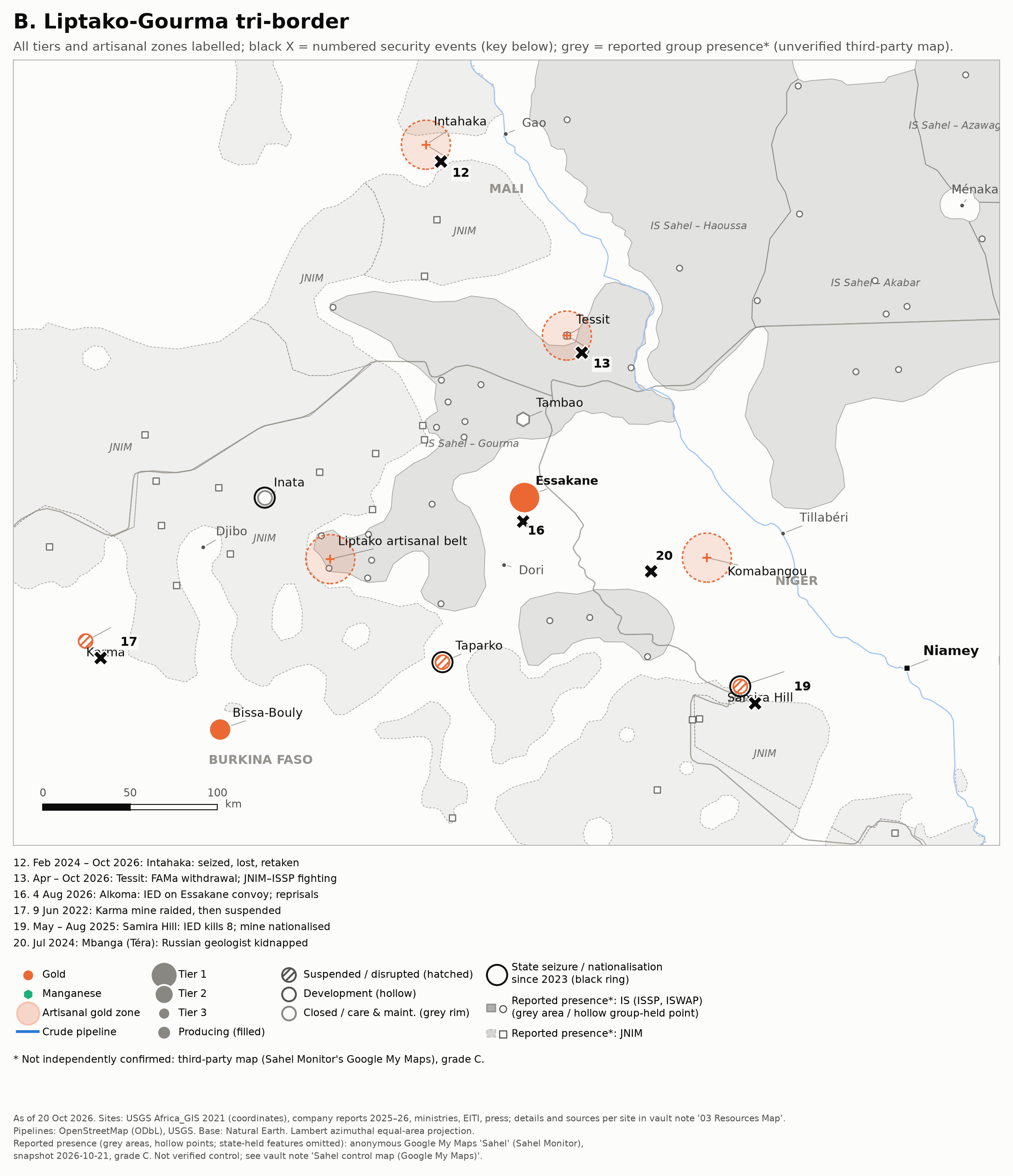 Zoom B: Liptako-Gourma tri-border.